 |
| 


Terrible
"Camera doesn’t connect to app and quit working after a year of having it."
There’s Never Been More Safety in Simplicity
Discounts for Military, First Responders, Teachers and Students through
![]() See Terms
See Terms


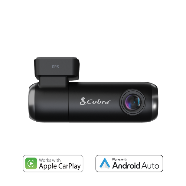
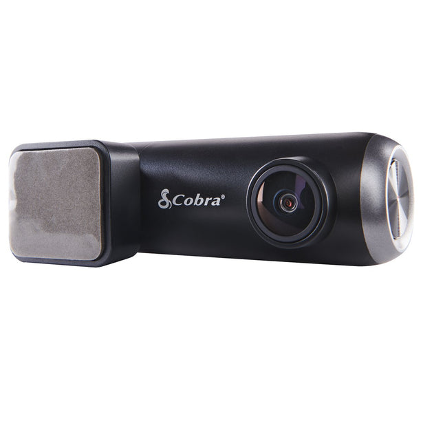
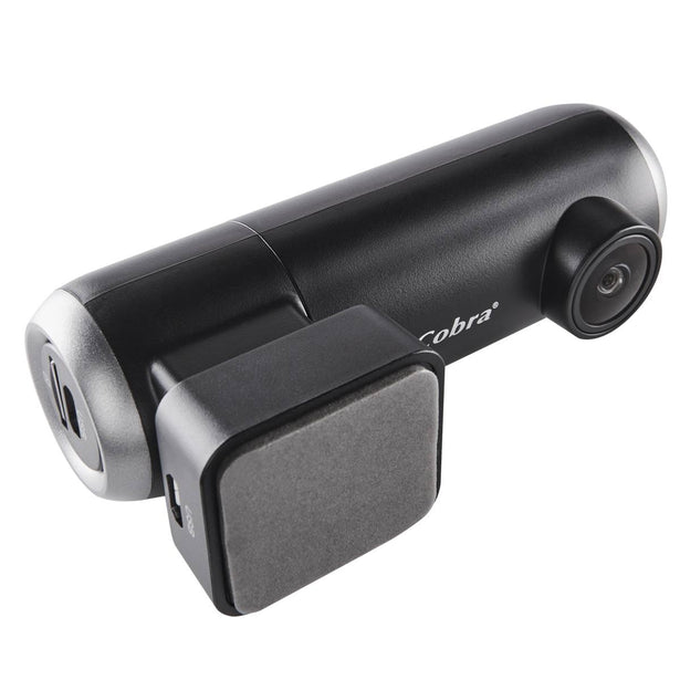
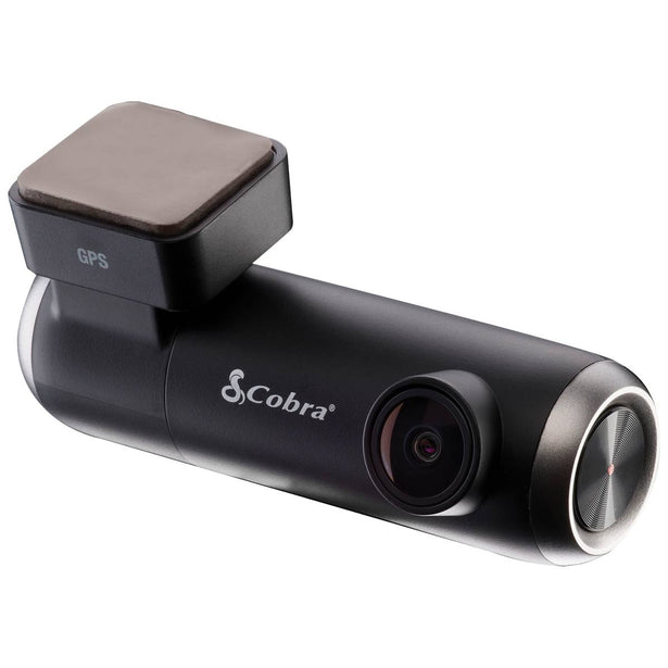
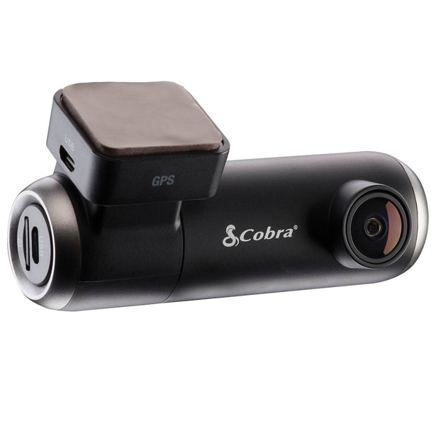
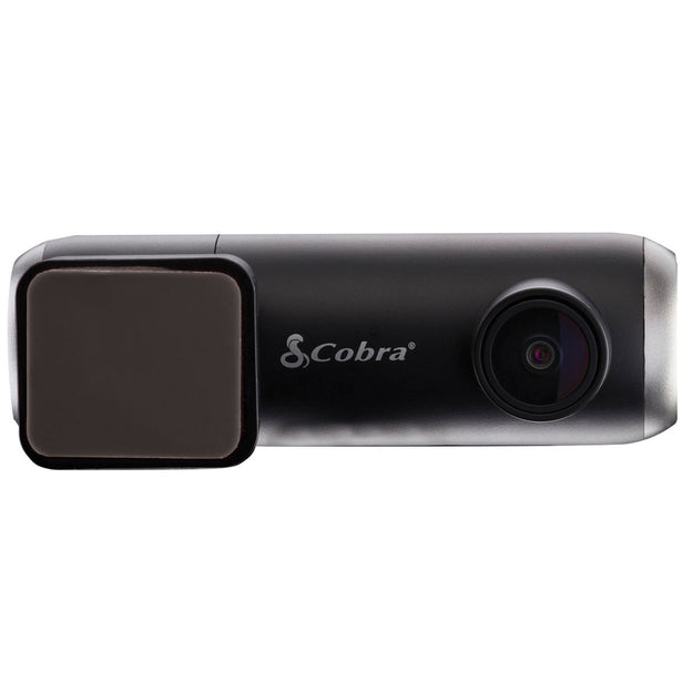
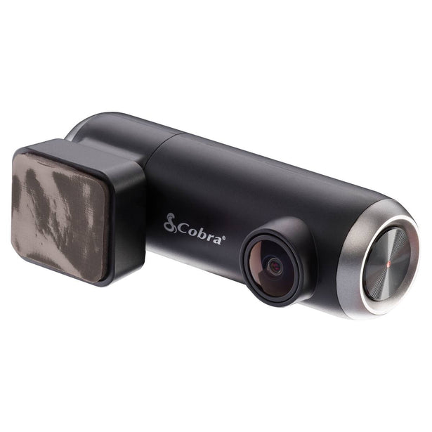
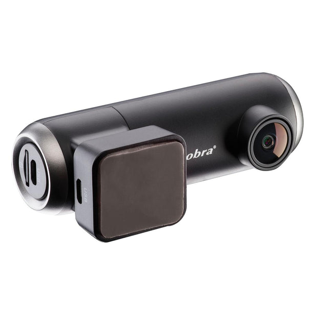
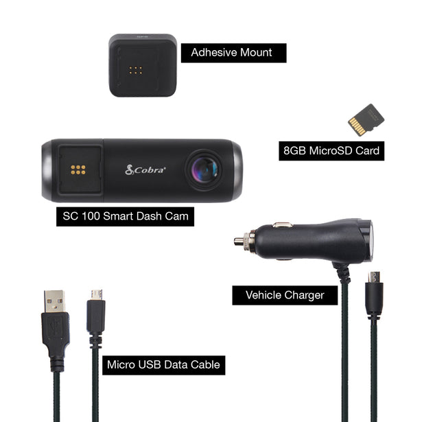
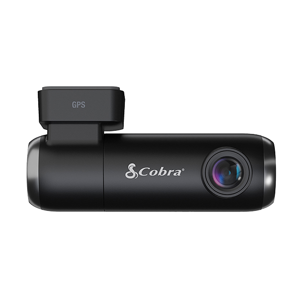
SC 100 gives you FHD 1080p resolution for front or rear recording, plus live police alerts, Incident Reports, and Mayday Alert if a severe impact is detected
Featuring Full HD 1080P video resolution that continuously records the road ahead
An included SD card and cloud storage allow you to record locally and save emergency videos and photos in the cloud
Built-in WiFi allows you to instantly store, edit, and share footage from anywhere
A minimal, screen-free design allows SC 100 to stay out of the way. Press a button to quickly save clips & snapshots.
A quick and secure magnetic GPS mount makes removing and reinstalling your dash cam a breeze
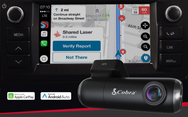
Get notifications of red light camera locations, speed traps, and more when connected to Drive Smarter App


Featuring Full HD 1080P video resolution that continuously records the road ahead, you'll be able to capture anything that may happen
An included SD card and cloud storage allows you to record videos locally and save emergency videos and photos in the cloud
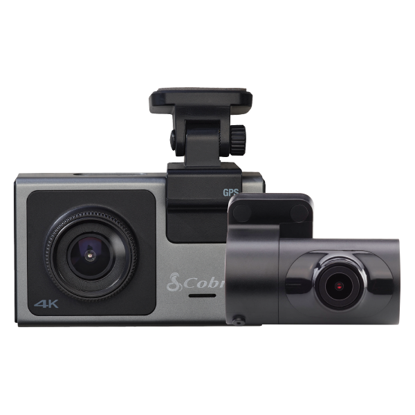
Record ahead, behind, and even inside the vehicle all at the same time so you can cover all the angles and know exactly what happened
Get notifications of red light camera locations, speed traps, and many more alerts from our nationwide network of drivers and sensors


Included with every new Cobra SC 100:

With 13 parts & accessories available for Cobra SC 100, customize your setup and be ready for any journey.

Take your knowledge to the next level. Get information and product support all in one convenient location.
User Manuals
SC 100 Quick Start Guide - Spanish
SC 100 Quick Start Guide - German
Update Your Device
Connect your device to the Drive Smarter® app to update your device to the latest software. Firmware downloads are also available for installation directly to the device using a Micro SD memory card.
Item # SC100
Is my camera compatible with Drive Smarter?
Cobra's SC Series cameras (SC100, SC120/110, SC120, SC 200/200D, SC201, SC220C, SC250R, and SC400/400D) are compatible with Drive Smarter. Drive Smarter does not support legacy Cobra dash cameras (DASH Series, CDR Series) at this time.
Do I need to pay for Drive Smarter?
No, Drive Smarter is a free service provided to users of our SC Series cameras.
Why am I having trouble connecting the Camera in Drive Smarter?
You may have previously established a Bluetooth connection with the camera. If this is the case, please go into your phones OS Bluetooth menu and 'Unpair' your camera from your phone.
How can I use the MayDay feature?
Simply enable the G-Sensor and Mayday setting on your camera, andenter your Emergency Contact info into Drive Smarter. From there, Drive Smarter and the Dash camera will take care of the rest. If the camera detects that you have been in a serious collision (Level 5 G sensor event) it will automatically lock the latest recording and notify your emergency contact.
How do I connect my camera via WiFi?
You do not need to manually establish a WiFi connection to your Dash Cam. Drive Smarter uses Bluetooth to automatically manage connection types depending on which feature you are using within the app. If you are using a feature that requires WiFi, the app will walk you through establishing a a Bluetooth connection. Note: Older Android Operating systems (Android 6, 7, and 8) may prompt the user to exit the app and connect via the OS WiFi menu.
Overall rating: 3.7777777 / 5 from 45 reviews.
The Cobra SC 100 offers FHD 1080p resolution for front or rear recording, live police alerts, Incident Reports, and Mayday Alert for severe impacts. Customers praise its video quality and dashcam features, though some have issues with the camera functionality.
Review topics: ["shipping","quality","problem","works","camera","dash cam","video","picture","cam","cobra","app","sd card","install"].
"Camera doesn’t connect to app and quit working after a year of having it."
"ive had it for less then a year and it won't record anymore, I've tired resetting and it does want to record. Was working fine but now just dissapointed :("
"Do not like it. Want camera on dash cam. Not a dash cam connected to phone. Want to return and purchase a dash cam with camera attached. Nothing connected to phone. Waiting to hear and last week. Your customer service is not very good."
"Great video when I can access them. A lot of issues with accompanying app. Must down load to computer to view. Annoying voice when going over the speed limit. Keeps repeating to slow down every few seconds and cannot adjust."
"Once you have the camera installed and start to use it you expect to be able to easily view the images and video . But no, constantly says unable to locate cam or out of range even when sat in the car. Constantly updating which downloads a new update but still does nothing to help. When trying to view the video it would be nice to be able to rotate the picture but it doesn't allow it."
"Simple installation. It was kind of a hassle getting it connected. 10/10 would still recommend!"
"Excellent product 👌"
"Records in poor quality."
"Yeah, item has not been at my doorstep yet. Not sure where it is."
"Great product for the money."